
www.industryemea.com
19
'26
Written on Modified on
Advanced Digital Twin Software Unifies Large-Scale Spatial Data Processing
Artec 3D introduces a new computational platform designed to integrate multiple geospatial capture formats into highly detailed digital replicas for complex environments.
www.artec3d.com
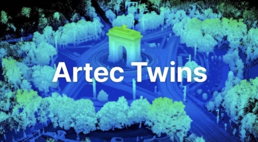
Artec 3D is releasing Artec Twins, a digital twin software platform built to process, analyze, and visualize massive multi-source 3D datasets. The platform centralizes spatial data handling to support demanding mapping, inspection, and surveying workflows across the architecture, engineering, construction (AEC), mining, infrastructure, and public safety sectors.
Multi-Source Integration for Large-Scale 3D Data Processing
Originally developed to complement the Artec Jet SLAM mobile LiDAR scanner, the software architecture accepts inputs from various terrestrial and aerial technologies, including stationary 3D scanners, drones, satellites, and mobile photogrammetry devices. By combining analytical tools with heavy-duty processing algorithms, the system allows project teams to merge vast topographic overviews with highly detailed localized scans. This unified digital model environment eliminates the standard workflow fragmentation where different capture scales require distinct third-party software.
“Existing solutions often force users to choose between different capture methods,” explains Art Yukhin, President and CEO of Artec 3D. “Some support handheld 3D scanning, others SLAM-LiDAR or aerial capture, but rarely all of these technologies within a single environment.” By enabling multi-technology ingestion within a single local workstation environment without relying on external cloud transfers, the platform also secures proprietary data for sensitive infrastructure operations.
High-Fidelity Rendering and Geometry Preservation
A primary technical challenge in generating spatial models is managing the computational load of point clouds containing billions of individual coordinates. The platform's processing engine achieves rendering speeds up to 200 frames per second without relying on data decimation. This capability allows users to interact with environments exceeding 100 square kilometers, navigating the full-resolution model in real time without losing critical geometric detail.
“We’ve designed an engine capable of processing very large point clouds without decimation or latency," adds Yukhin. "Geometry remains a priority to guarantee the reliability of measurements, while the same data also allows us to produce visualizations tailored to presenting the results.” Analytical visualization overlays, including height, normals, intensity, and color mapping, provide operators with specialized views to detect structural anomalies or material characteristics. First-person navigation controls allow engineering teams to conduct virtual site inspections and extract precise spatial measurements directly from the unified dataset.
Gaussian Splatting for Complex Surface Reconstruction
The software introduces Gaussian splatting capabilities, a rendering technique that utilizes photographic and video data alongside LiDAR point clouds to generate high-fidelity 3D scenes. This approach resolves common photogrammetry and scanning challenges, specifically the representation of highly reflective or translucent materials that traditional meshing algorithms struggle to reconstruct accurately. Operators can toggle seamlessly between measurement-optimized point clouds, polygonal meshes, and visually accurate Gaussian splats within the same interface. This ensures that a single project file can serve both the strict geometric requirements of engineering analysis and the visual fidelity needed for stakeholder presentations.
Geospatial Alignment and Volumetric Analysis
To function as a viable tool for industrial surveying and maintenance, the system includes native support for georeferencing and ground control points (GCPs). This aligns the captured datasets with real-world coordinate systems. Surveyors and engineers can calculate distances, extract cross-sections, compute material volumes, and fit geometric primitives to the scanned data. By overlaying the physical point clouds against original computer-aided design (CAD) files, users can conduct automated deviation analyses, verify construction tolerances, and monitor site degradation over successive temporal scans.
Additional Context
This section details technical specifications and competitive benchmarking not included in the original news release.
Within the industrial 3D data processing market, platforms like Leica Cyclone, Trimble RealWorks, and FARO Scene traditionally dominate the management of massive terrestrial laser scanning datasets. These established systems heavily utilize dynamic Level of Detail (LOD) and data decimation algorithms to maintain workstation performance when rendering multi-gigabyte point clouds. The Artec 3D platform distinguishes itself by sustaining continuous high-framerate navigation on un-decimated data, prioritizing absolute geometric integrity for micro-measurements within macro-environments. Furthermore, while competing software relies primarily on point clouds and photogrammetric meshes, the native integration of Gaussian splatting directly alongside SLAM and terrestrial LiDAR data provides a unique hybrid rendering approach. This bridges the gap between metrology-grade inspection software and high-end architectural visualization engines, streamlining the transition from data capture to final structural analysis.
Edited by Aishwarya Mambet, Induportals Editor, with AI assistance.
www.artec3d.com
